No Hiking Boots? No Problem! Experience Seoul Trail 2.0
Explore Seoul Like a Local: Master the 156km Seoul Trail
If you search for “Hiking in Seoul,” Google will immediately point you toward Bukhansan National Park. Don’t get me wrong—Bukhansan is majestic. But if you want to experience the soul of the city without the knee-shattering granite peaks or the need for professional mountaineering gear, there is a Local Secret you need to know: The Seoul Trail 2.0.
In this guide, I’ll show you why this 156km network of trails is the best-kept secret for international travelers and how you can conquer it like a local.
Source: Seoul City Official Website
What is the Seoul Trail 2.0?
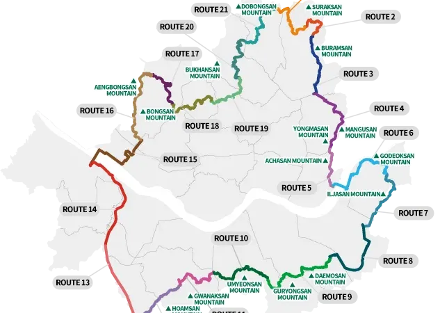
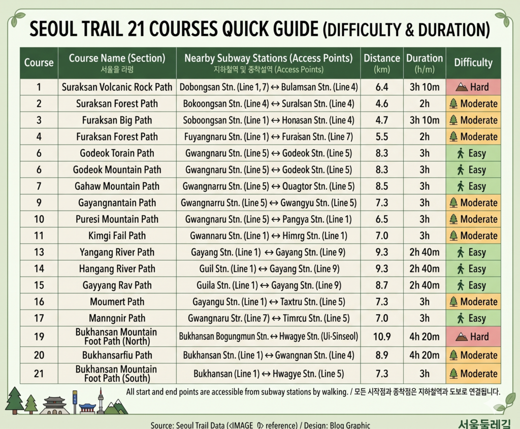
The Seoul Trail is a massive circular route that hugs the outer edges of the city. In 2024, the city government revamped the system, turning the original 8 long sections into 21 manageable courses.
This is a game-changer for tourists. Most courses now take only 2 to 4 hours to complete, meaning you can hike in the morning and be back in Myeongdong for shopping by the afternoon.
The “Local Secret” Appeal:
Subway Accessibility: Every single one of the 21 courses begins and ends within walking distance of a Seoul Metro station.
No Gear Required: While Koreans love their high-end hiking fashion, most of the Seoul Trail is paved or consists of gentle forest paths. Your comfortable walking sneakers are plenty.
Safe for Solo Travelers: Seoul is one of the safest cities in the world, and these trails are well-populated by friendly locals.
Source: Roamad Blog (https://roamad.blog/places/korea/seoul/seoul-trail-dullegil/)
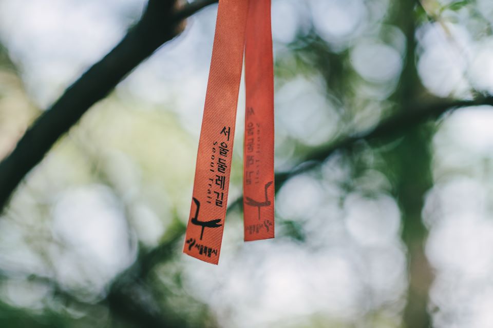
How to Navigate: The Magic of the “Orange Ribbon”
One of the biggest fears for travelers is getting lost in a foreign forest. Here is the secret: Follow the Orange.
The Seoul Trail is marked by orange ribbons tied to tree branches, orange arrows on poles, and orange medallions on the ground. If you haven’t seen an orange marker in 5 minutes, you’ve taken a wrong turn. It’s that simple.
Pro Tip: Don’t rely solely on Google Maps. In South Korea, Google Maps often lacks detailed trail data. Download Naver Maps or Kakao Maps. Even if the interface is in English, the GPS tracking is 100% more accurate for local hiking.
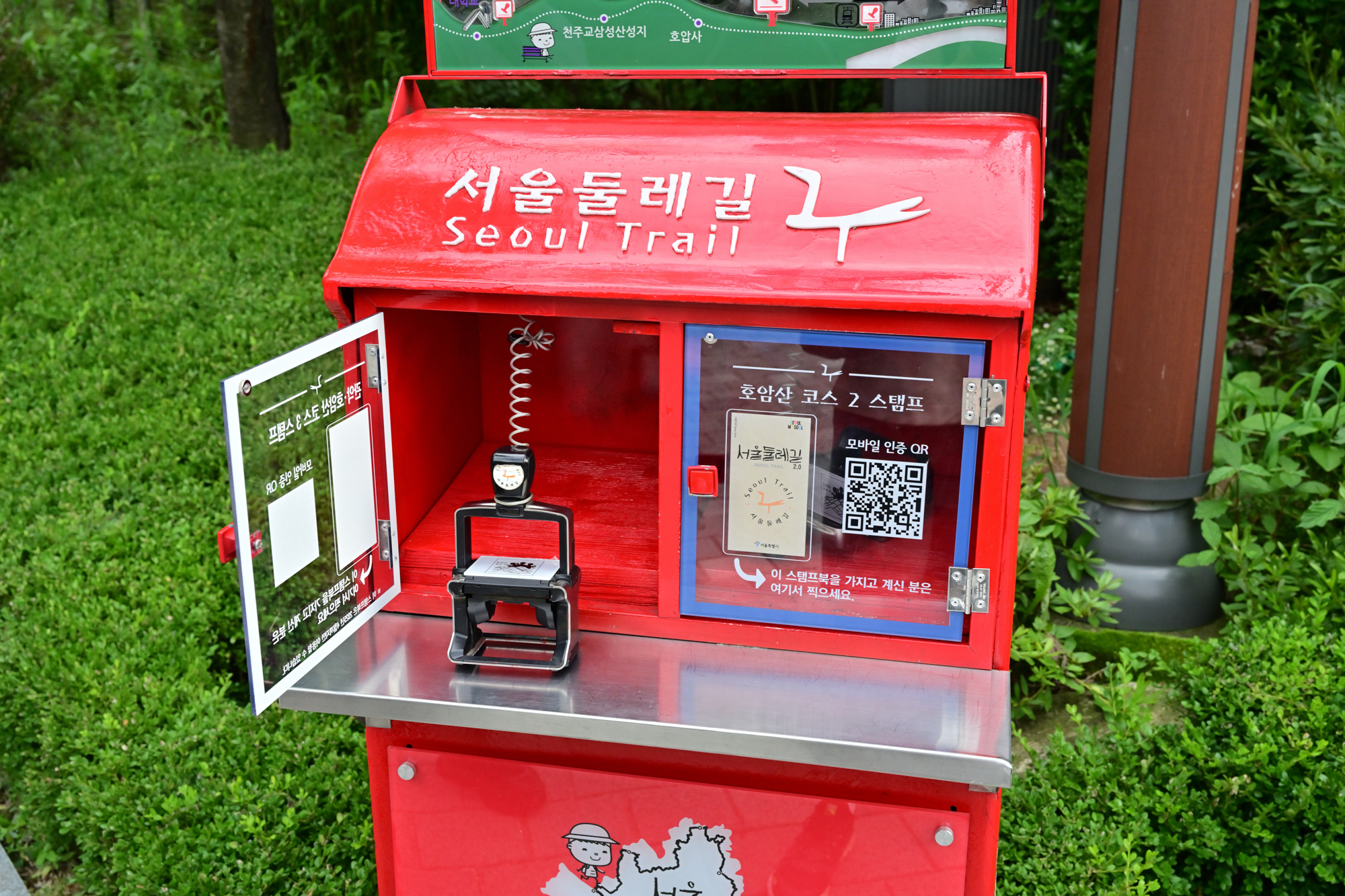
The “Quest”: Collecting Your Stamps
Koreans love a challenge. Along the 156km trail, there are 28 red stamp boxes. They look like vintage mailboxes. Inside, you’ll find a rubber stamp unique to that section.
If you go to the Seoul Tourism Plaza (near Jongak Station), you can pick up a physical Stamp Book for free. Once you collect all 28 stamps, you can return there to receive an Official Completion Certificate. It’s the ultimate souvenir that money can’t buy!
A red stamp box for the Seoul Trail stamp tour challenge
The Top 3 Courses for Beginners
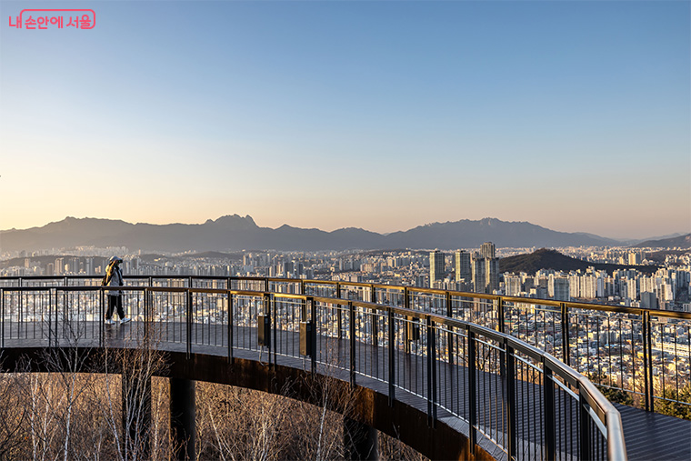
1. Course 7: The Sunset King (World Cup Stadium to Gayang Station)
If you only have time for one hike, make it this one. It takes you through Haneul Park (Sky Park).
The Secret: The view of the Han River at sunset from the top of the wooden stairs is better than any view from the N Seoul Tower, and it’s completely free.
2. Course 14: The Forest Bath (Guryongsan to Daemosan)
Located near Gangnam, this course feels like a deep mountain escape. It’s mostly shaded by dense trees, making it perfect for a hot summer day.
3. Course 11: The Heritage Walk (Uiryeong Pass)
This section offers a glimpse into Seoul’s history, passing through quiet neighborhoods and ancient stone walls.
What to Eat: The Hiker’s Ritual
You cannot say you’ve hiked in Korea without the “Post-Hike Meal.” Near the exit of almost every trail, look for restaurants serving:
Pajeon (Green Onion Pancake): Crispy, savory, and perfect for sharing.
Makgeolli (Rice Wine): The traditional drink of hikers. It’s milky, slightly sweet, and very refreshing.
Traditional Korean hiking meal: Pajeon (pancake) and Makgeolli (rice wine).
Essential Packing List (Affiliate Recommendations)
To make your hike comfortable, here is what I recommend:
A Lightweight Daypack: You don’t need a 40L rucksack. A simple 15L pack is perfect.
Portable Power Bank: Between taking photos and using GPS, your battery will drain fast.
T-Money Card: You’ll need this for the subway ride to the trailhead.
Conclusion: See the Real Seoul
The Seoul Trail 2.0 isn’t just about exercise; it’s about seeing the city from a different perspective. You’ll see grandpas exercising on outdoor “forest gyms,” hidden Buddhist temples tucked into valleys, and views of the skyline that most tourists never imagine.
Ready to start your journey? Pick a course, follow the orange ribbon, and discover the secret side of Seoul!